
 James Hutton Cycle Trail
A challenging route of 51.5km through interesting geology in East Berwickshire.
James Hutton in Berwickshire
James Hutton was born in Edinburgh in 1726. After studying at universities in Edinburgh and on the continent, in 1754 he moved to Berwickshire, where he had inherited family farms at Slighhouses and Nether Monynut. He spent 10 years in Berwickshire, mainly at Slighhouses and made many improvements to arable farming methods there. He recognised the importance of drainage and the use of lime in improving the soil, and was instrumental in introducing new ploughing techniques to increase land productivity.
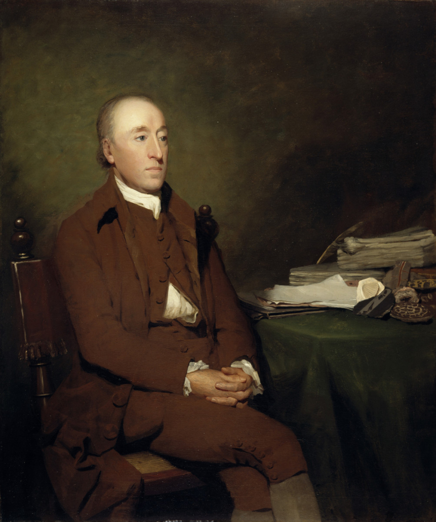
James Hutton by Sir Henry Raeburn
Hutton was a lifelong scholar. After his time in Berwickshire, he travelled widely, following his passion for geology and mixing with leading figures in the Edinburgh scientific establishment. From his studies and observations, he deduced that the Earth was very much older than the generally accepted view at the time, and sought to find proof of his theory. He finally found this at Siccar Point, where base layers of grey rock, originally deposited as horizontal beds, have been tilted vertically and then overlain by younger red sandstone layers. To explain this structure, Hutton suggested that a vast period of time had elapsed between the deposition of the grey and red rocks. Thus was born the concept of ‘Deep Time’ – a fundamental principle of modern geology
The Trail – Location, Facilities & Safety
The route follows public roads. Care must be taken. Beware of other traffic and also of farm animals and farm machinery. The route crosses the A1 at Grantshouse. Dismount to cross. Anyone using this guide does so at their own risk.
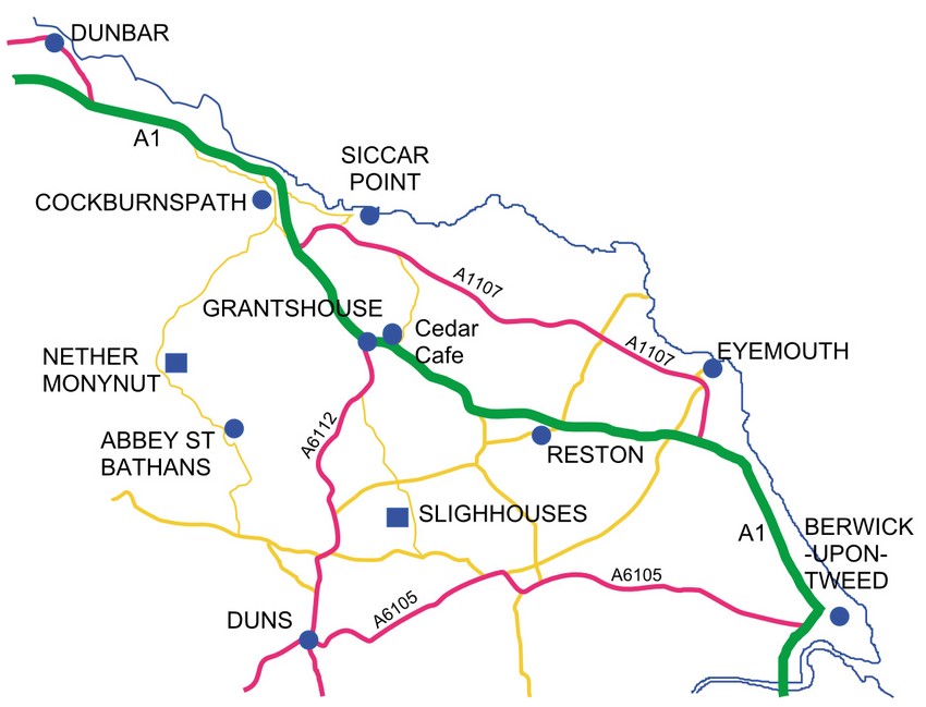
The route as described below starts at Cockburnspath, but can be accessed at any other suitable point. There are other roads to shorten the route if required. National Cycle Route 76 forms part of this trail.
There are train stations at Reston, Dunbar and Berwick-upon-Tweed. The 253 bus runs from Berwick to Dunbar and calls at Reston, Grantshouse and Cockburnspath. It can carry two cycles.
There is a community shop at Cockburnspath and cafés at Abbey St Bathans, the Cedar Café near Grantshouse and the Pease Bay Holiday Park.
There are public toilets at Cockburnspath and near to the Cedar Café. All details are correct at time of publication, but should be checked before setting off, especially the bus and train timetables.
Trail Route
Route Map
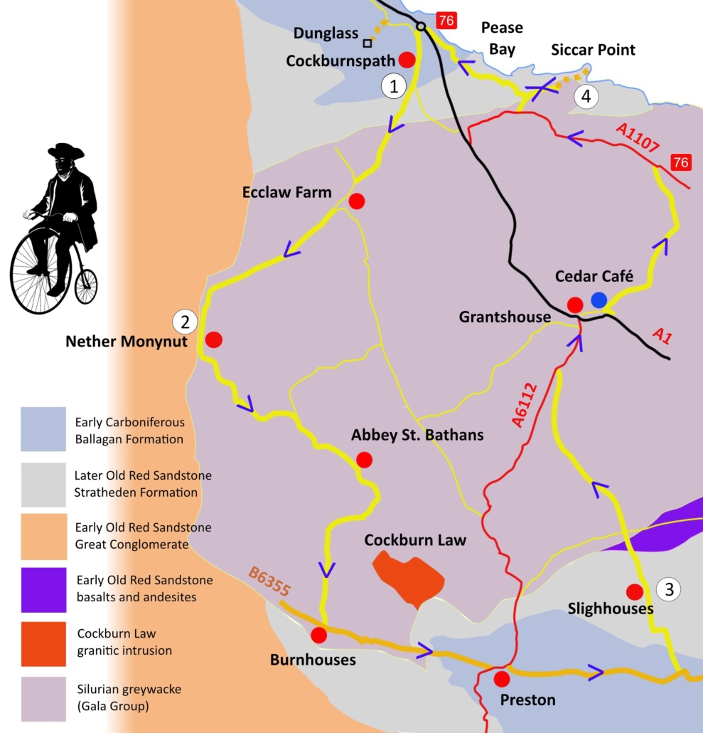
1 Cockburnspath to Nether Monynut
1 Cockburnspath NT 7744 7111 to Nether Monynut NT 7274 6453: 6 miles/9.6 km
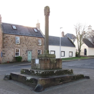 Geology: Cockburnspath village lies on early Carboniferous rocks, mostly sandstones, limestones and mudstones (Ballagan Formation). The older buildings use sandstones as the main building stone, with good examples seen near the Mercat Cross.
Cycle downhill from the car park in the middle of the village, then turn right opposite the white granite war memorial, signed towards Berwick. After 0.8km, turn right towards Abbey St Bathans. The road rises as it crosses onto Old Red Sandstone rocks which are more resistant to weathering and erosion than the Ballagan rocks.
Geology: Shortly after the junction are two aggregate pits, one on either side of the road. Fulfordlees and Kinegar quarries exploit sand and gravel from glacial meltwater deposits. Just before the road reaches the Holiday Park on the left, the unconformable contact between the Old Red Sandstone rocks and the Silurian greywackes (Gala Group) is passed and the steep slope in front of you marks a change in landscape onto the greywackes of the Lammermuir Hills.
Cross the bridge over the Heriot Water and then take the steady climb up to Ecclaw Farm, noting Hoprigshiels wind farm to the right.
Shortly after Ecclaw Farm, with its farm buildings of greywacke with very large quoins of Old Red Sandstone, turn right onto the road signed to Monynut. After a cattle grid, the next two miles are largely on an unfenced road.Watch out for lambs in spring/early summer. In clear weather, there are panoramic views of the Lammermuir Hills.
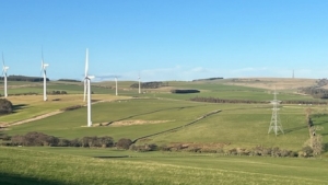 After Paitshill Farm the road continues to climb gently before crossing the steep-sided cleugh of Whare Burn, a tributary of Whiteadder Water, and then descending steeply to Nether Monynut.
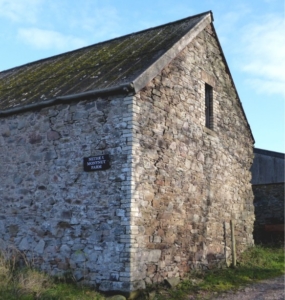 This hill farm was passed down to James Hutton through his family and he carried out farming activities here between 1754 and 1767. The land was moorland, probably used only for grazing, with woodland on the steep slopes of the Monynut valley. Hutton’s farming improvements allowed the farm to be tenanted when he moved to Edinburgh in 1767.
Cycle past Nether Monynut farm buildings and then descend steeply into the Monynut valley, reaching an information board on your right about 0.8km beyond the farm (NT 7307 6402).
Geology: About 0.8km beyond the farm is a quarry on the left, exposing superficial deposits above an exposure of near-vertical Silurian greywackes. Just past the turning to Bushelhill Farm, about 0.4km beyond the information board, is a high cliff of vertical greywackes on the left amongst trees.
2 Nether Monynut to Slighhouses
2 Nether Monynut NT 7274 6453 to Slighhouses NT 8246 5943: 12.7 miles/20.4 km
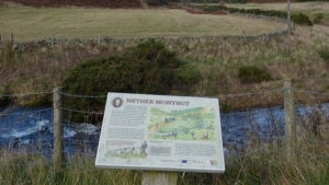
Follow the Monynut Water downstream through mixed woodland. At the cottages at Bankend, turn right onto a road signed to Abbey St Bathans and Preston. Continue alongside the Monynut Water and after crossing the bridge over Whiteadder Water, arrive in Abbey St Bathans. Pass the lane to the Church on your left and continue for another 500m where there is a sign for Woodlands Café (only open at weekends). Large groups visiting the café should phone in advance. (Tel 07908 669905)
From the café, the route climbs for 3km away from the river into wooded country. Climb past ‘Toot Corner’ and after a short level section, look left to see the gentle slopes of the granodiorite of Cockburn Law. The route descends steeply through woodland to Burnhouses. Here, turn left opposite the farm onto the B6355, direction Duns and Preston. After 4km, turn left before the Millburn bridge, direction Preston.
Geology: The Millburn valley widens into an alluvial flood plain as the route approaches the southern side of the Lammermuir Hills. Before Preston, the route crosses the Whiteadder at Cockburn Mill Ford and leaves the greywackes of the Lammermuirs, crossing into Old Red Sandstone rocks, followed shortly by the Carboniferous Ballagan Formation sandstones, mudstones and cementstones. You have now reached the Merse, the agricultural region of the Tweed Valley, lying between the Lammermuirs and the igneous (granite/andesite) rocks of the Cheviot Hills to the south.
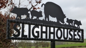 Arrive in Preston opposite the village hall and bear left onto the A6112. At a sharp bend at the east end of the village, turn right to rejoin the B6355, direction Chirnside. The next 4km are flat cycling through mixed farmland, with occasional views of the Cheviots, until the road on the left signed to Lintlaw is reached. The rubble building stones of Lintlaw include dark blocks of greywacke and andesite, suggesting that the boundary of the greywackes and lavas is not far away. Slighhouses Farm is found 1.5km north of Lintlaw on the left. Slighhouses was described as “open,treeless with clumps of gorse, areas of wet ground and marshland”, in Hutton’s time.
3 Slighhouses to Siccar Point
3 Slighhouses NT 8246 5949 to Siccar Point: 10.7 miles/17.2 km
From Slighhouses, the route climbs steadily uphill as it approaches the the southern side of the Lammermuirs. You will cross the the Old Red Sandstone/Silurian boundary just before the crossroads with the B6438 at the former smiddy. At the top of the hill at the Thief’s Road track, there are several glacial drainage valleys which carried meltwater to the east and south. The road descends to the north through another meltwater valley past Monashee Farm and Drakemyre, before descending to meet the A6112 at Berryhill Cottage.
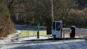 Turn right and descend for around 2km with views over the valley of the Eye Water which is floored by glacial till, to reach the A1 at Grantshouse. Dismount and cross the main road with care into Grantshouse village, then turn right. Note the use of greywacke building stone in the former chapel and in some of the old dwellings as you continue along the main street to reach the cycle repair station.
Descend on to a path running east alongside the A1. Take the first turning left towards the Cedar Café. There are public toilets and a picnic area in the lay-by. Turn left along the lane alongside the café. The lane climbs steeply uphill for 4km, passing Howpark Farm, then between the Penmanshiel and Drone Hill wind farms to reach the A1107. Turn left downhill with fine views of the coast to the north.
Geology: Look along the coast towards the Carboniferous limestones, sandstones and mudstones on the first headland, the site of Torness nuclear power station. To the right is the volcanic island of Bass Rock (phonolitic trachyte), beyond which the hills of Fife can be seen on a clear day. Left of Torness, industrial chimneys mark the Dunbar cement plant, located next to a large limestone quarry. Farther left is the dramatic hill of North Berwick Law, similar in geology to Bass Rock. Inland, the slopes rise steadily onto the greywackes of the Lammermuir Hills, more resistant to erosion than the sedimentary rocks of the East Lothian lowlands.
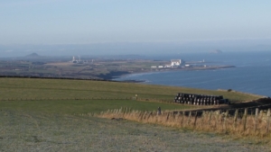
Pass through Old Cambus and after 1.5km, take the second right towards Pease Bay. After 0.4km, ignore the road to the left and proceed past the sign for ESG Drysdale, reaching the start of the Siccar Point Deep Time Trail on the left after a further 0.4km. Just beyond is a spectacular dry gorge, another meltwater drainage channel. Access to Siccar Point is by foot from this point.
4 Siccar Point to Cockburnspath
4 Siccar Point NT 8011 7051 to Cockburnspath NT 7744 7111: 2.75 miles/4 km (4 miles/6.5 km if the visit to Dunglass Collegiate Church is included)
Retrace your route westwards for 0.8km then turn right steeply downhill towards Pease Bay. Cross the ford or use the footbridge over the Pease Burn. The car park immediately on the right allows access to the sands, with spectacular Old Red Sandstone cliffs at the west end of the bay. A restaurant and small shop are available in the Holiday Park buildings.
Cycle uphill to the west for 2km, passing the road to Cove village on the right, then turn immediately left and follow the marked cycle route under the A1. On reaching the road just north of Cockburnspath, either:
a. Turn left into the village, then right opposite the war memorial to return to your starting point, or
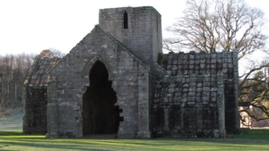 b. Turn right, then first left towards Dunglass. Follow this road for 0.8km then turn left at the gatehouse into the Dunglass estate NT 7670 7198. Leave your bike in the lay-by on the left and walk over the grass to visit the Collegiate Church, which contains interesting information and historical artefacts on the Hall family and their connection with Hutton and Siccar Point.
From the church, retrace your route back to Cockburnspath and your starting point at the Mercat Cross.
Acknowledgements
Route by Ann and Ian Kellie. Text by Ann and Ian Kellie and Alison Tymon. Maps by Alison Tymon. Layout by Barry Tymon.
Maps data from OpenStreetMap and British Geological Survey. Cycle Trail logo adapted from artwork by Scottish Borders Council. James Hutton portrait © National Galleries of Scotland Collection. Man on bicycle drawing by Cara Croman
Funded by Cockburnspath and Cove Community Council and The Edinburgh Geological Society.
© 2026 Edinburgh Geological Society.