The ‘Lost Drawings’ are a set of drawings and engravings that were prepared to illustrate James Hutton’s “Theory of the Earth”. They were mostly drawn by Hutton’s friend John Clerk of Eldin, although two of them are by another friend, James Hall. The two remaining volumes of the Theory of the Earth (volumes 3 and 4) remained unpublished on Hutton’s death in 1797, so the drawings were never used and disappeared. They were rediscovered in 1968 and a set of 29 facsimiles were produced.
We are very grateful to Sir Robert Clerk for donating these high-quality facsimiles to support fund-raising for the celebration of James Hutton’s Tercentenary in 2026.
Lost Drawing facsimiles are available in return for a donation here
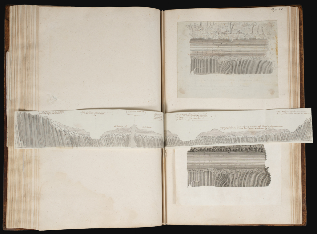
Photograph of the original ‘Lost Drawings’ currently held by the Hunterian in Glasgow.
View the Lost Drawings below
For convenience, the Lost Drawings are here separated into broad geographical areas.
Edinburgh & Fife
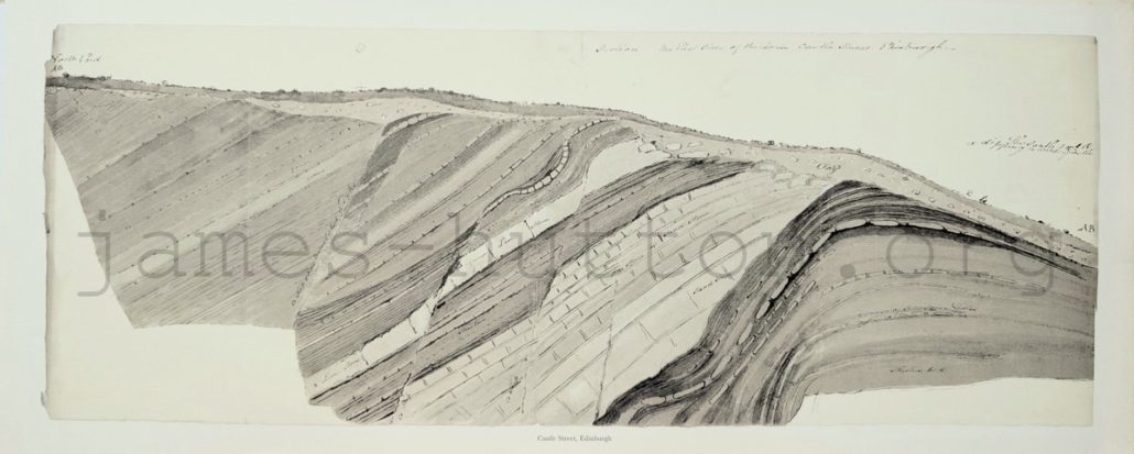
1 Castle Street, Edinburgh
69 x 29 cm
This is a cross section through several metres of rock, perhaps in a trench or foundations for a building. It shows a sequence of sedimentary rocks – sandstone, limestone, and ironstone – with a thin covering of clay with embedded pebbles and soil. The rocks have been slightly deformed after they were deposited, and generally dip to the north. They contain a small fold at the southern end, and are cut through by a few small faults. We now know that these sedimentary rocks were formed early in the Carboniferous Period, around 340 million years ago. This drawing, and others in the sequence, show a good understanding of the variety of rocks found in the centre of Edinburgh and an interesting level of detail of how these layers are arranged underground.
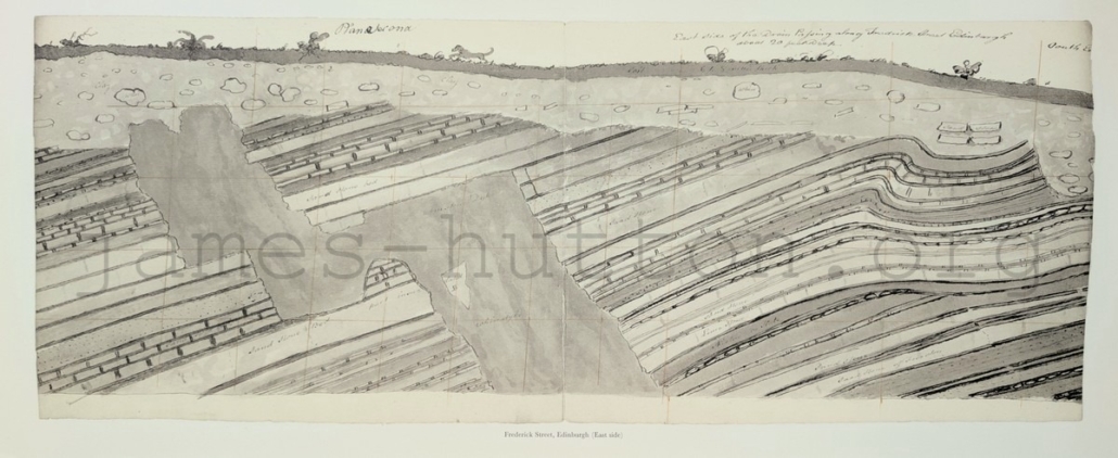
2 Frederick Street (East side)
69 x 30 cm
One block east of Castle Street, the cross-sections at Frederick Street show the same layers of early Carboniferous sedimentary rocks seen there. But at Frederick Street, the drawings also show interesting additional detail with a cross-cutting dyke of igneous rock. This supports James Hutton’s theory that igneous rock is formed from magma injected through existing rocks, in this case showing a clear cross-cutting relationship where the magma has taken an irregular route through the sedimentary strata. The dyke is described as “whinstone”, which is an old name for microgabbro (dolerite), or diabase: a medium to fine grained, dark coloured igneous rock. This particular dyke is part of an east-west trending dyke swarm injected towards the end of the Carboniferous Period, which are found across the south of Scotland. Some of the boulders in the overlying clay are also labelled as whinstone.
3 Frederick Street (West side)
68 x 29 cm
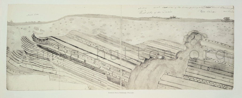
This illustration is a mirror-image of the east side of Frederick Street and would have helped James Hutton and John Clerk to understand the three-dimensional structure of the geology. It shows that the whinstone dyke was laterally continuous across the street. Interestingly, the folds at the south end of this section are associated with small faults, while the east side section only shows folding.
4 Salisbury Crags (three drawings)
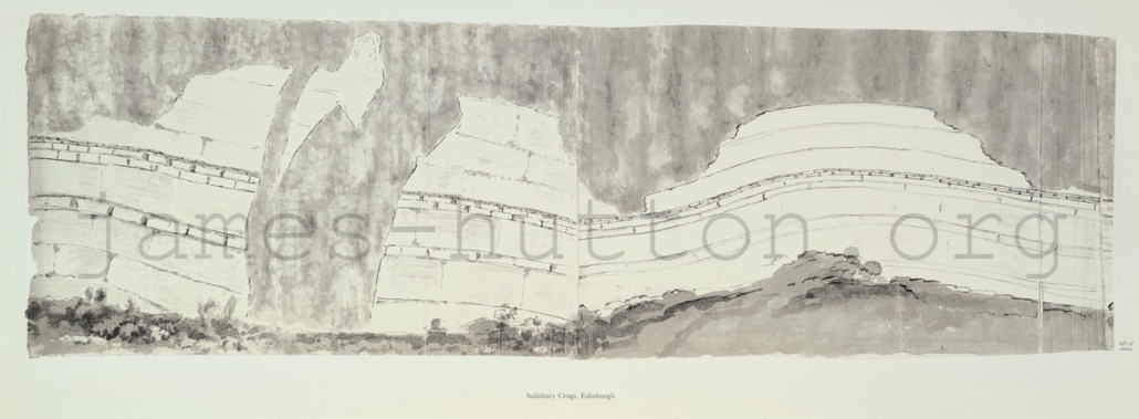
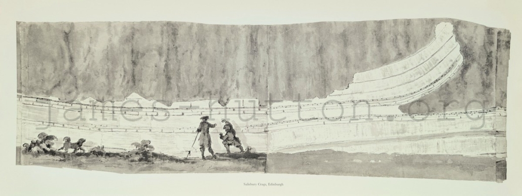
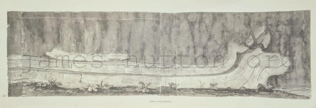
These three images form a triptych, allowing us to trace the geological strata across all three illustrations. They demonstrate that Salisbury Crags is a sill intrusion within a sequence of sedimentary rocks. We now know that the sedimentary rocks were deposited early in the Carboniferous Period, about 345 million years ago, and were intruded by magma about 10 million years later. The Left panel shows how the sill is connected to a dyke cutting through the sedimentary rocks. The Middle and Right panels show how the magma has squeezed between the sedimentary layers, forcing layers of sandstone to buckle and bend. These illustrations don’t quite match the rocks known today as Hutton’s Section, which is just off the Radical Road in Holyrood Park, Edinburgh. This is celebrated as an important, accessible site where Hutton could demonstrate that igneous rocks must have originally been molten, rather than formed from seawater at the same time as the sedimentary rocks. We don’t know if this is an accurate depiction of rocks that were later removed by quarrying, or if John Clerk employed some artistic licence in illustrating and exaggerating some of the features that were visible along the cliff.
4a Salisbury Crags (Left)
66 x 26 cm
4b Salisbury Crags (Centre)
66 x 26 cm
4c Salisbury Crags (Right)
74 x 26 cm
5 Arthur’s Seat and Salisbury Crags
44 x 24 cm
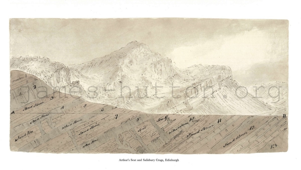
This stunning sketch shows the landscape of Arthur’s Seat, viewed from the north, sliced open in a geological cross section. It beautifully illustrates how underlying geology can shape the landscape. The section shows layers of sandstone, dipping to the east (left), with igneous sills intruded between the strata and connected by dykes (the sills and dykes are labelled as whinstone, now known as microgabbro (dolerite), or diabase). St Anthony’s Chapel is visible on the left, in a ruined condition similar to how we find it today. This sketch illustrates James Hutton’s understanding of igneous rocks formed by the injection of magma into existing rocks (sedimentary rocks in this case). Modern interpretations agree with Hutton for the formation of Salisbury Crags (layer 8), but we now understand the higher layers are older rocks that are part of the Arthur’s Seat volcano. This includes lava flows forming layers 2 and 4, and minor intrusions below the volcano forming The Dasses – ledges on the north side of Arthur’s Seat – at layer 6.
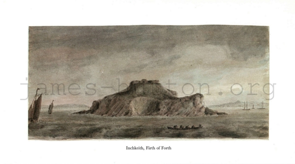
6 Inchkeith
29 x 17 cm
Inchkeith is an island in the Firth of the Forth and this view is from the northwestern side, just off Kinghorn in Fife. The cliffs of the island show basaltic lavas and ash layers of Carboniferous age, interbedded with sedimentary rocks, with the whole sequence dipping to the east.
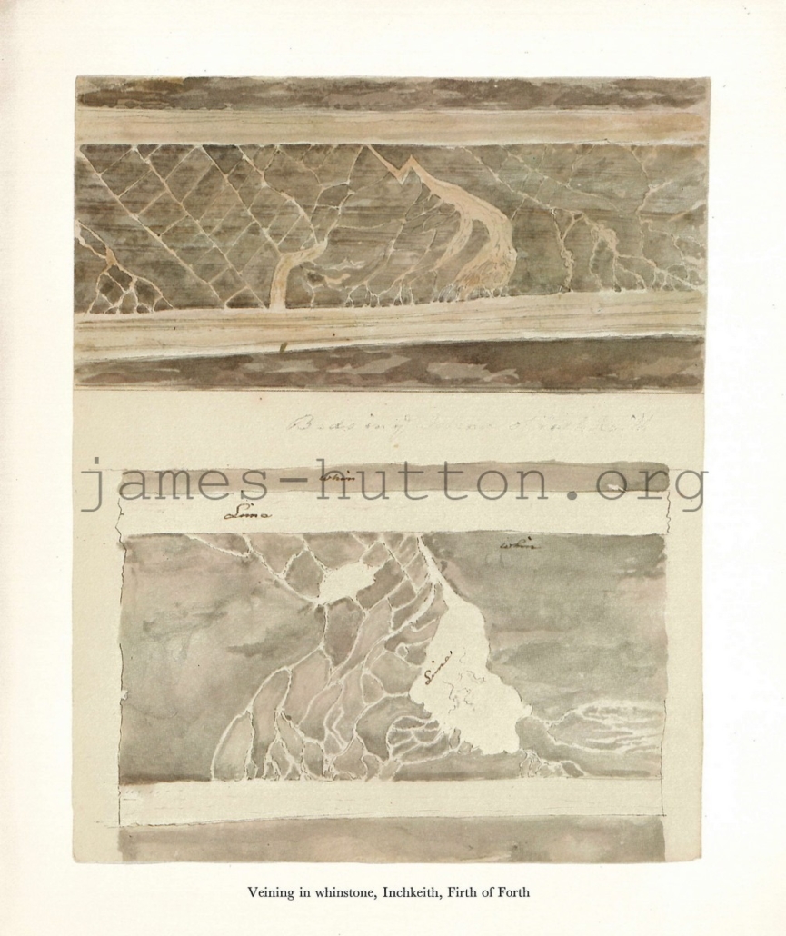
7 Veining in Whinstone, Inchkeith
29 x 25 cm
These illustrations show veins running through the basaltic volcanic rocks of Inchkeith (here labelled as “whinstone”). While the images are striking and clearly show the processes of rock fracturing and formation of mineral veins in the fractures, the lack of scale is frustrating when it comes to interpreting and understanding these images.
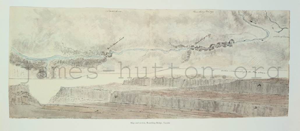
14 Map and Sections, Rumbling Bridge
62 x 28 cm
This is a map of the River Devon, beginning at Crook of Devon in the east and flowing approximately 5 miles to the south-west. Modern geological maps show that this is an area of complex geology, with Devonian-age volcanic rocks to the north-east, and younger Carboniferous sedimentary rocks to the south-west; the two main rock types are separated by a fault near Rumbling Bridge. Clerk and Hutton seem to have misunderstood the geology, and assumed that the Carboniferous sedimentary rocks to the south (with a ‘whinstone’ intrusion) continued underground to the north-east at a gentle dip; in fact they terminate at the faultline.
Strathclyde
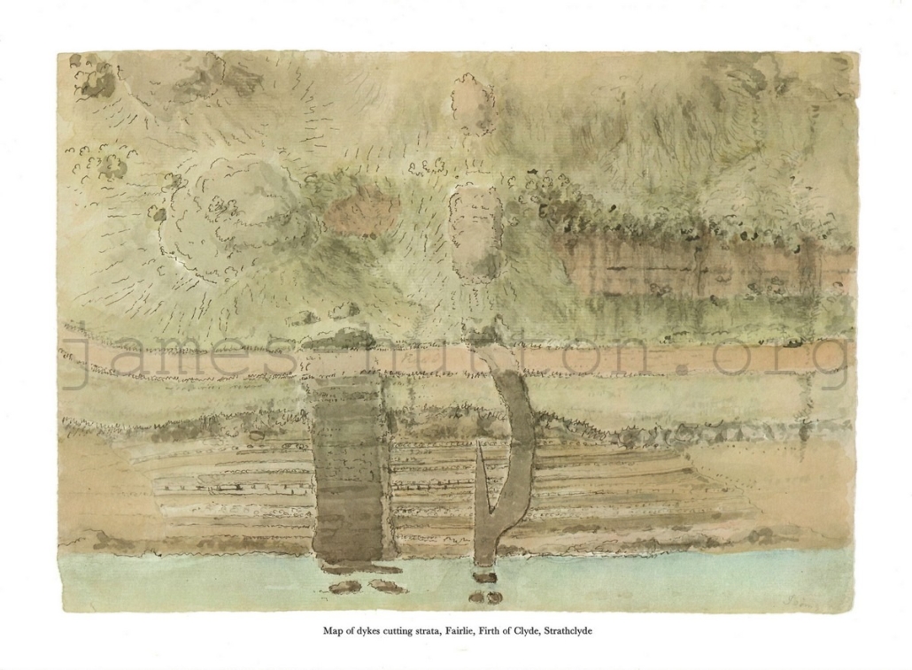
15 Map of Dykes Cutting Strata, Fairlie
40 x 29 cm
This map of the foreshore at Fairlie, Ayrshire, is oriented with north to the left and east to the top. The sedimentary rocks on the foreshore formed in the late Devonian Period, and dip east (inland). There are two cross-cutting dolerite dykes that trend east-west.
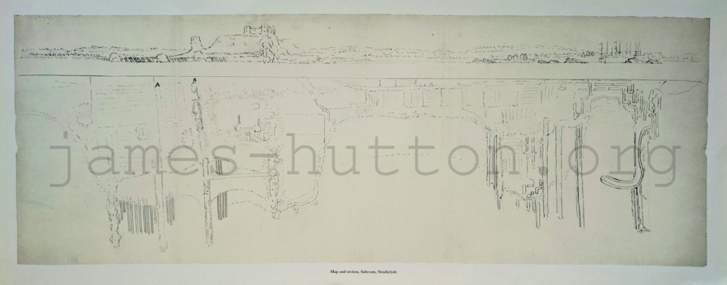
16 Map and Section, Saltcoats
78 x 32 cm
This map and topographic section show the coast at Saltcoats, oriented with northeast to the top. Saltcoats Castle is to the left and the harbour (with masted ships) to the right. Both the map and section show details of the Carboniferous sedimentary rocks that strike inland and dip to the south-east (right).
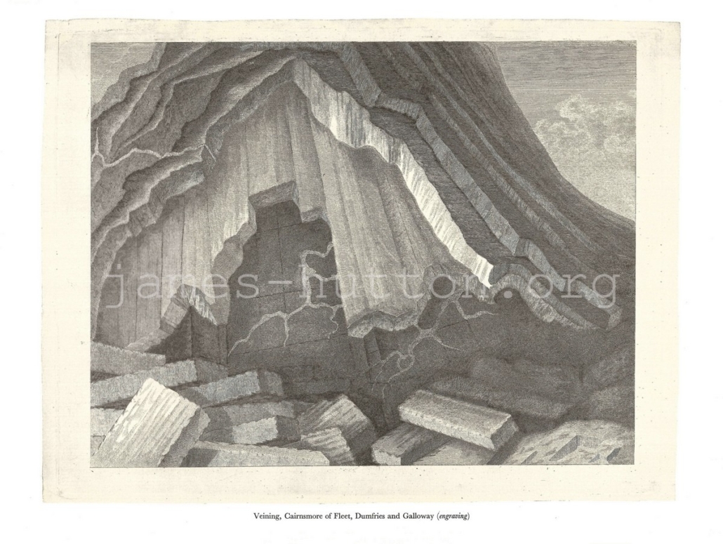
17 Veining, Cairnsmore of Fleet
40 x 31 cm
This stylistic drawing of the granite at Cairnsmore of Fleet shows prominent jointing in the granite, with fallen blocks that are shaped by the joint systems. There are veins within the darker igneous rock at the back.
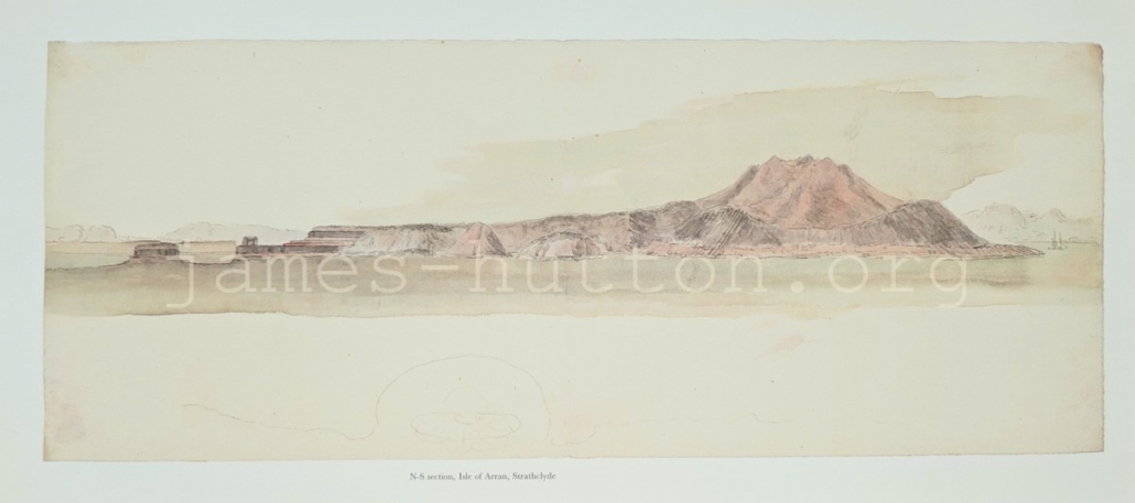
18 N-S Section, Isle of Arran
56 x 25 cm
This illustration combines the Arran landscape with a cross section through the entire island. On the left you can see horizontal sedimentary rocks that we now know are Triassic in age, around 250 million years old. In the north, surrounding the Arran Northern Granite, are folded and deformed Dalradian metamorphic rocks. This is one of a series of drawings that demonstrate that Hutton and Clerk understood the intrusive nature of the granite on Arran.
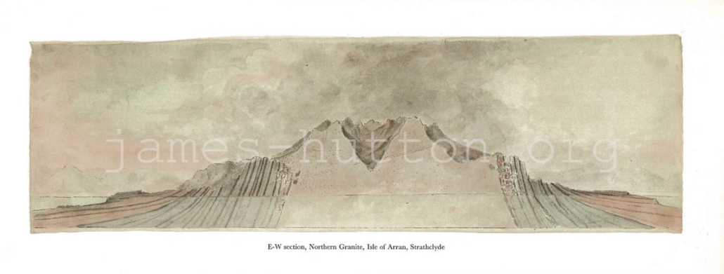
19 E-W Section, Northern Granite, Isle of Arran
44 x 17 cm
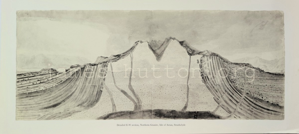
This cross section across northern Arran shows the granite intruding through steeply dipping Dalradian metasedimentary rocks (grey) that are unconformably overlain by a sequence of sedimentary rocks from the Devonian through to the Permian (420 – 252 million years old, in red). We now know that the granite in the centre of the complex is only about 60 million years old.
20 Detailed E-W Section, Northern Granite, Arran
53 x 24 cm
Scottish Borders
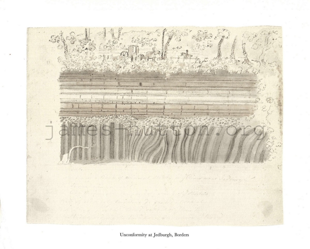
21 Unconformity at Jedburgh, Borders
29 x 24 cm
This illustration and engraving show the Allars Mill unconformity at Jedburgh in the Scottish Borders, in the banks of Jed Water. Geologically similar to Siccar Point, the section shows vertical and folded Silurian (445-415 million year old) sedimentary rocks overlain by horizontal Old Red Sandstone, deposited around 360 million years ago. As at Siccar Point, the illustrations show a layer of broken fragments (breccia) of the underlying rock at the base of the Old Red Sandstone.
22 Unconformity at Jedburgh, Borders (engraving)
30 x 24 cm

23 Section across Southern Uplands
82 x 14 cm
This cross section spans 40 miles, running north-south from the Lammermuir Hills near Edinburgh (on the right) to the Scotland-England border (on the left). It shows steeply dipping Ordovician-Silurian sedimentary rocks that are overlain in places by Devonian conglomerate and sandstone.This is the same relationship that is illustrated in more detail at Jedburgh and Siccar Point.

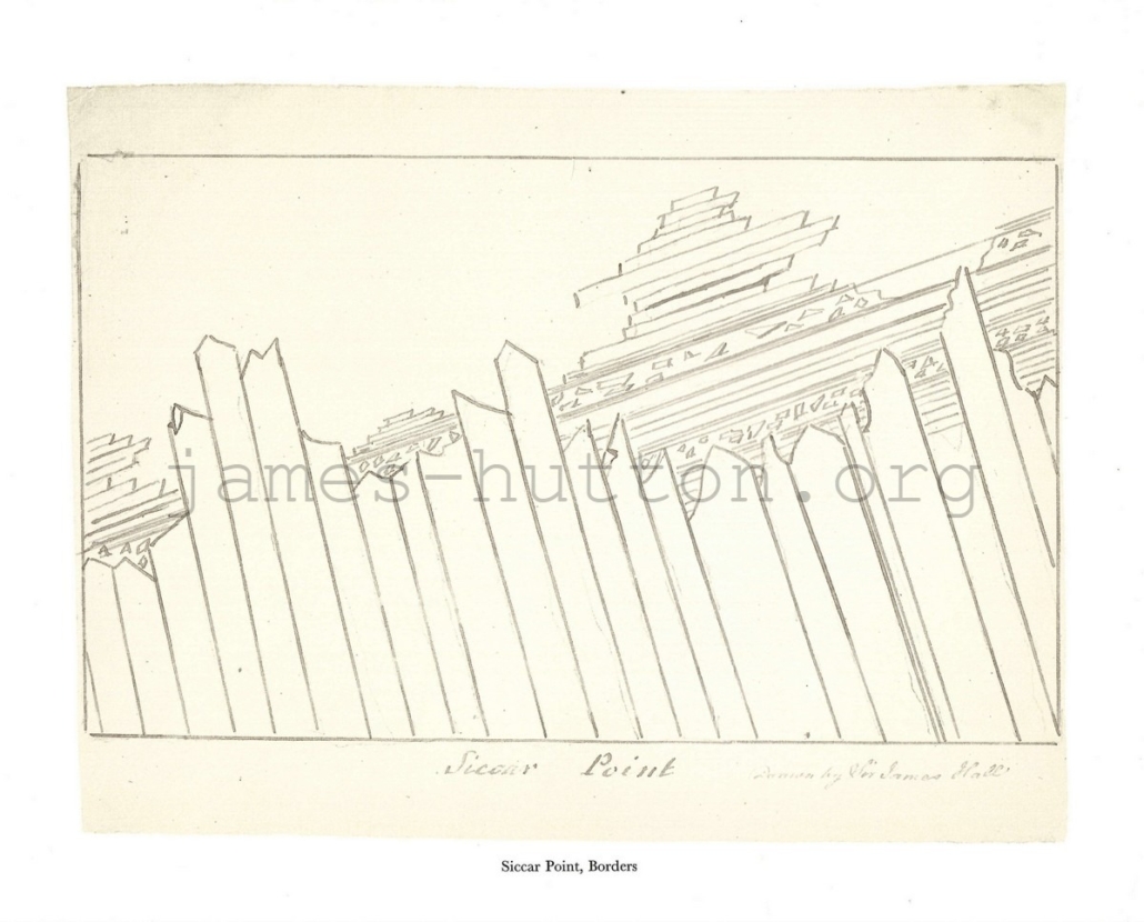
24 Siccar Point
32 x 26 cm
Unlike most of the other Lost Drawings, this sketch is by James Hall, rather than John Clerk. It schematically shows the steeply dipping Silurian greywacke sandstone layers with their jagged and uneven Devonian erosional surface, overlain by the Devonian Old Red Sandstone. The jagged ornamentation in some of the Devonian layers represents layers of breccia: fragments of the underlying greywackes that were incorporated into the Old Red Sandstone.
25 Folds near Siccar Point
34 x 26 cm
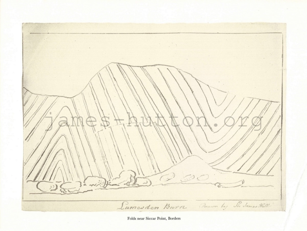
Another sketch by James Hall, this time showing the shape of the folds in the Silurian greywacke sandstone. A small fault offsets some of the beds in the centre of the image. Hutton realised that a long period of time was required to deposit, lithify, fold, and then erode these sedimentary rocks.
Glen Tilt
8 Boulders from the River Tilt
30 x 22 cm
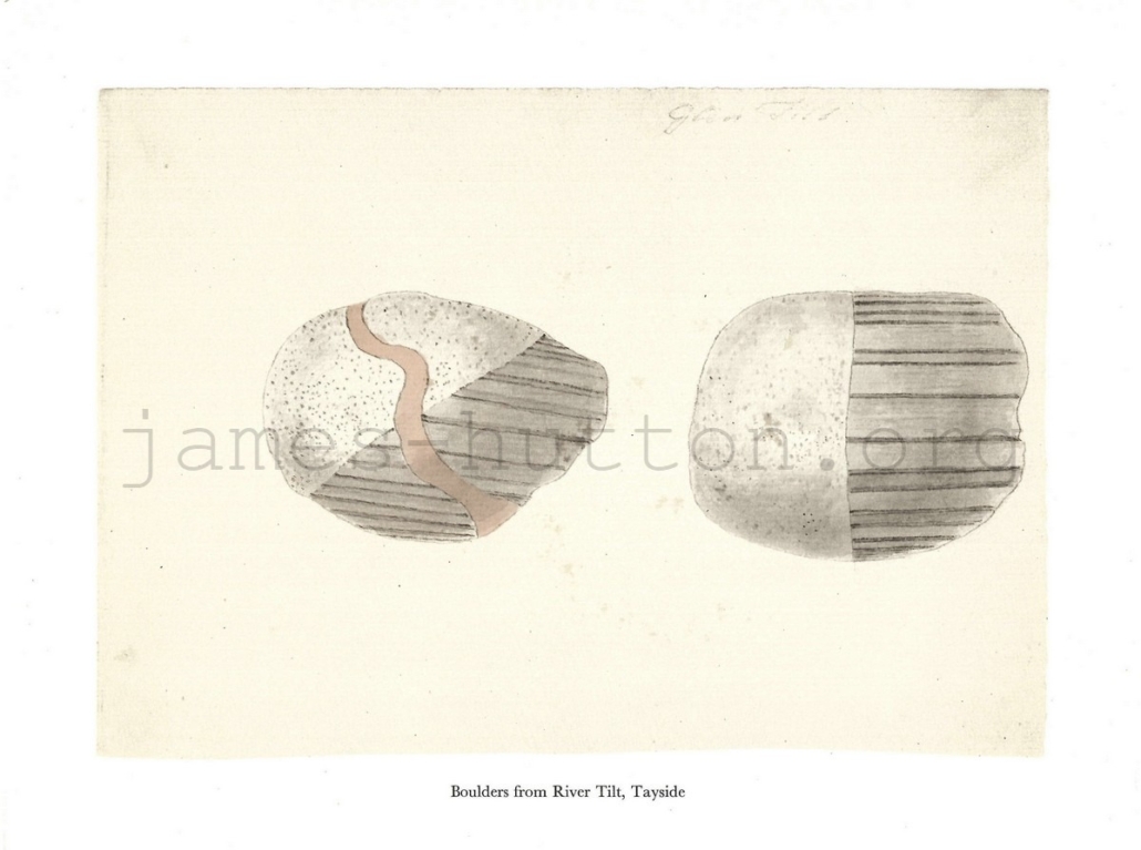
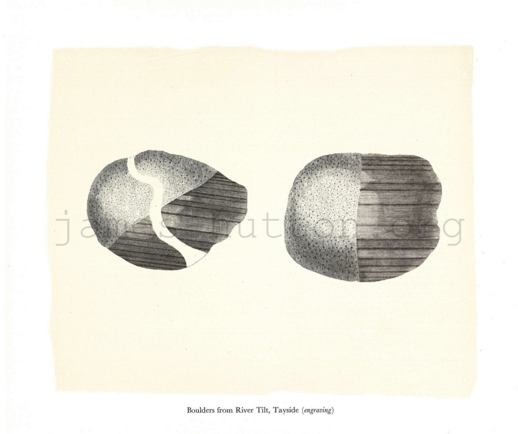
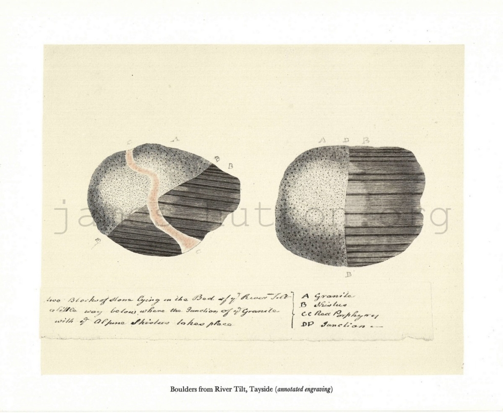
These three prints show the same two boulders illustrated in different ways. The boulders were found in the River Tilt and each shows the boundary between the Glen Tilt granite (which we now know to be about 430 million years old) cutting through older “schistus” – Dalradian metamorphic rock. The older rocks were originally deposited as marine sediments more than 600 million years ago and were later folded and metamorphosed to create a highly foliated rock, illustrated by the banding. The left hand boulder is cut by a later vein of porphyry, a minor intrusion.
9 Boulders from the River Tilt (engraving)
28 x 25 cm
10 Boulders from the River Tilt (annotated engraving)
30 x 24 cm
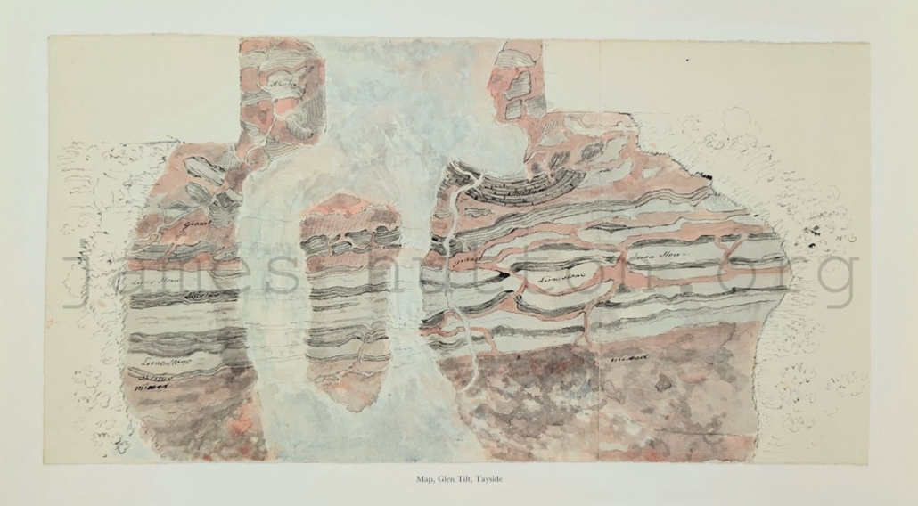
11 Map, Glen Tilt, Tayside
50 x 28 cm
A detailed map of a famous location in Glen Tilt, Perthshire: this is the first location where James Hutton described granite forming by intrusion of magma into existing rocks. The boundary of the Glen Tilt granite, cutting through the older Dalradian metamorphic rocks, is exposed in the bed and banks of the River Tilt.
In the coloured version, the granite is coloured pink and dominates the top half of the exposure, where it is intruded into the grey Dalradian rock. In the centre of the image, the granite forms veins that cut through the Dalradian rock. The river is flowing south-west down Glen Tilt, from bottom to top of the coloured image, with the road to the right of the river (not shown, but see map 14). Many of the features in the map can still be seen today.
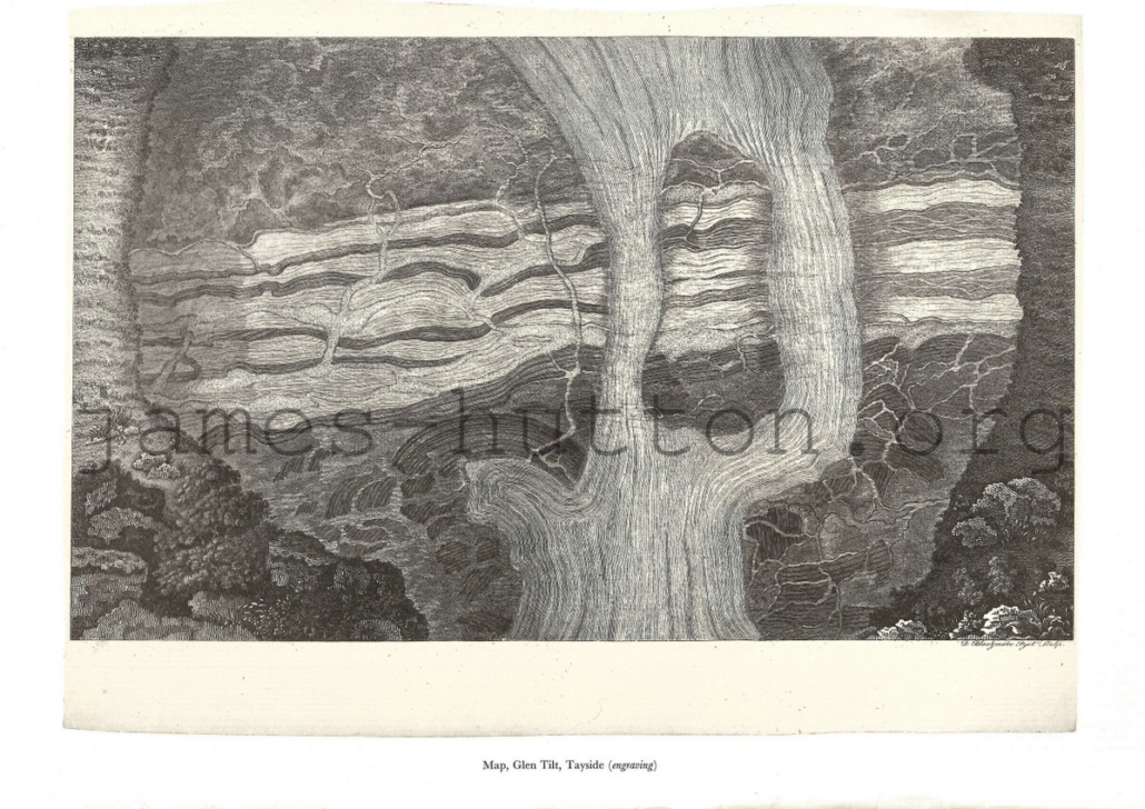
12 Map, Glen Tilt, Tayside (engraving)
44 x 35 cm
Note that the engraving is upside down compared to the coloured version.
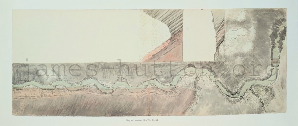
13 Map and Sections, Glen Tilt, Tayside
63 x 28 cm
While the work of geniuses of the Scottish Enlightenment, this map and cross section are an excellent example of why geology students are taught about the importance of adding scale, orientation, and legend to their maps and sketches. The map shows a section of the River Tilt flowing from left to right (to the south-west) approximately between Forest Lodge (to the left) and Marble Lodge (to the right) with south-east at the top of the map. The pink at the bottom of the map shows the granite that forms the north-west side of the glen.
The cross-sections are harder to interpret, but show the boundary between granite (pink) and the strata of the Dalradian metamorphic rock, dipping to the south-east. James Hutton realised that in general the Dalradian strata strikes north-east to south-west and that this gives the general lie of the land across much of the Highlands.
Isle of Man
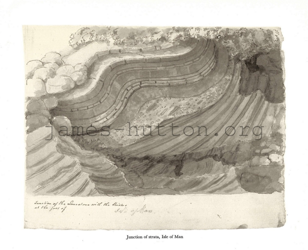
26 Junction of Strata, Isle of Man
31 x 25 cm
This image shows a disconformity between overlying limestones and underlying “schistus”. This location is likely on the south of the island, near Castletown and the Langness Peninsula, where Carboniferous sediments and limestones overly much older Ordovician rocks.
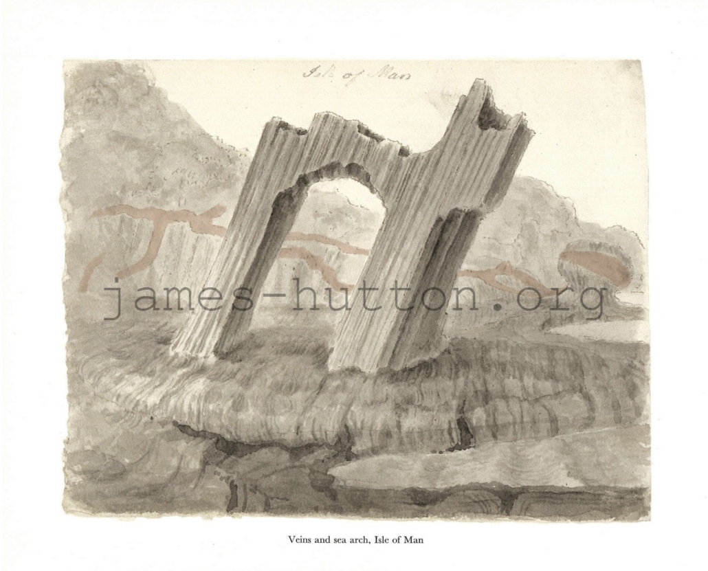
27 Veins and Sea arch, Isle of Man
31 x 25 cm
This beautiful sketch shows how the steeply dipping bedding of the rocks controls the shape of the sea arch and stack. Veining is picked out in the cliffs behind the sea arch.